Home    Overview   Maps    Photos    Improvements    Legal    Contacts


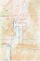
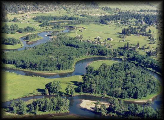
Lost Bison Ranch consists of 320 acres in Sweet Grass County. All perimeters fenced, as well as internal fencing for pastures; water rights to springs, seeps and creek; a lush, subirrigated meadow; all water and mineral rights convey with property. A conservation easement with Montana Land Reliance is in place.

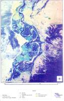
The ranch is a half-hour south of Big Timber (mostly paved road) and just one and a half hours from Bozeman, the nearest airport. It is accessible year-round. Elevation ranges from 5200-5600 ft. Approximately 40 acres of the property are on the west side of the Boulder River, with 280 acres on the east, and about a mile of Boulder River frontage

.

A high-resolution (7.5') topographic map showing details of the property boundaries and surrounding elevation and terrain is available by clicking on the thumbnail to the right. This is a 6.5MB Adobe Acrobat file, and may take a significant time to download depending on your connection speed. If you do not have Adobe Acrobat, click here to obtain it at no cost.

A high-altitude aerial photograph with geographic data overlays is available as a 3.5MB Adobe Acrobat file. The photo shows corner boundaries, fence lines and other property features in detail. The image may take a significant time to download depending on your connection speed. If you do not have Adobe Acrobat, click here to obtain it at no cost.